
I ran the Warsaw Half Marathon in March 2026. A few months later, I went back to the route more slowly to look at what we passed: bridges, museums, monuments, palaces, planned districts, a fortress, a zoo, a port and a stadium built on another stadium.
Trip date: 22 March 2026
Warsaw Half Marathon route: Most Poniatowskiego, the Royal Route, Plac Krasińskich, Cytadela Warszawska, Warsaw Zoo, Port Praski and PGE Narodowy
I ran the Warsaw Half Marathon in March 2026. It was my fifth time at this race, so the route itself wasn’t new to me. But race day changes how you see the city. You notice the start zone, the crowd, the turns, the water points, the pace groups and the number on your watch. Buildings become background.
A few months after the race, I went back to walk some of the key sections of the route and take the photos I had missed on race day. By then Warsaw was already in autumn colours, although the weather felt surprisingly spring-like – not so different from the sunny conditions during the half marathon itself.
This time, of course, I followed the footpaths rather than the middle of the road. The photos in this post therefore show the same places from a slightly different perspective.
The official 20th Warsaw Half Marathon route started on Most Poniatowskiego and finished at Błonia PGE Narodowego. The race organisers also pointed out several landmarks along the course, including Most Poniatowskiego, the palm at Rondo de Gaulle’a, Pałac Prezydencki, the Polish Olympic Committee building, Warsaw Zoo and PGE Narodowy.

Starting on Most Poniatowskiego
Race day started for me before the start line, on the Błonia near Stadion Narodowy. We had arranged to meet there with a larger group from work. Almost 100 people from the company were running, which gave the event a different feeling from a normal solo race.
I came part of the way by tram, but got off earlier near Park Skaryszewski, my “home” parkrun, and walked towards the stadium. The atmosphere grew a little as we got closer. Not too much, because I wasn’t running for a personal best and, honestly, I wasn’t really running regularly at that point. My main focus in training was swimming. But bigger races always add something. That’s probably one of the reasons I keep coming back.
The race started on Most Poniatowskiego. For us it was mostly a place to find the right start wave, move with the crowd and not go too fast in the first few hundred metres. But the bridge itself is already part of Warsaw’s story.
The first kilometre: museum, palm, and too much speed
My plan was simple: don’t start too fast. The first 5 km were supposed to be around 6:30/km, and then I wanted to gradually increase the pace. It was a sensible plan, which is usually the first sign that I may not follow it.
Before the first kilometre was properly gone, we had the National Museum on the left. The museum began as the Museum of Fine Arts in Warsaw in 1862, and its current building on Aleje Jerozolimskie opened in 1938. I was already closer to 6:10/km than to the careful 6:30/km I had promised myself, so I wasn’t exactly studying the façade.

A moment later we reached Rondo de Gaulle’a, with the palm in the middle. This is one of those Warsaw objects that everyone knows, and because everyone knows it, it is easy to stop noticing it. But the palm is not simply a random object in a roundabout. Joanna Rajkowska’s project is called Greetings from Jerusalem Avenue, and Aleje Jerozolimskie literally means Jerusalem Avenue. The installation stands where Aleje Jerozolimskie meets Nowy Świat, and it plays with the street name, memory and the associations behind that place.
A central section of the Royal Route
Soon after that, the route moved into one of my favourite parts of the Warsaw Half Marathon: the central section of Trakt Królewski, the Royal Route. The full Royal Route is longer than the part we ran. It stretches beyond Nowy Świat and Krakowskie Przedmieście, continuing further south towards Łazienki and Wilanów. In the race, we used the central, most recognisable section: first Nowy Świat, then Krakowskie Przedmieście.

Nowy Świat already gives the route that older Warsaw feeling before the most obvious monuments appear. Then Krakowskie Przedmieście adds another layer: churches, institutions, monuments, palaces and state buildings close together. During a race, this isn’t sightseeing. It is more like running through a compressed version of symbolic Warsaw.
Around this stretch we passed the Copernicus monument, the University of Warsaw, Hotel Bristol and Pałac Prezydencki. There may also have been a quick angle towards Zamek Królewski and Kolumna Zygmunta, depending on where you were in the pack and where you were looking. The point is not that we had time to study these places. The point is that the route carried us through them.
The Copernicus monument is one of the classic points on Krakowskie Przedmieście. It was made by Bertel Thorvaldsen, funded by Stanisław Staszic, and unveiled in front of Pałac Staszica in 1830. A little further on, the University of Warsaw’s main campus brings another layer. The oldest university building there, Pałac Kazimierzowski, was built before 1643.

Hotel Bristol came soon after the university. It opened in November 1901 and is connected with Ignacy Jan Paderewski, Stanisław Roszkowski and Edmund Zaremba, who were behind the project. Then we passed Pałac Prezydencki. The palace became the official seat of the President of Poland in 1994, after renovation works that adapted it for that role.
By this point, I was still feeling good, which wasn’t necessarily good news. The first 5 km came out around 6:00/km, much faster than planned. It felt loose, but the watch was already telling me that the race wasn’t going according to the script.
Plac Krasińskich: one of the places to return to
After the Royal Route section, the course took us towards Plac Krasińskich. This is one of the places on the route where it is worth returning later.
During the race, it was another turn, another section of road, another part of the first half. Standing there without a race number, it becomes much more interesting. Pałac Krasińskich, also known as Pałac Rzeczypospolitej, was built in the late 17th century for Jan Dobrogost Krasiński, with Tylman van Gameren connected to its design. Today the square is also dominated by the Warsaw Uprising Monument, which adds another layer to a place already shaped by state institutions, wartime destruction and post-war reconstruction.

By this point, we had already passed a historic bridge, a museum, a public artwork, a monument, a university, a historic hotel and the Presidential Palace. Only a few kilometres into the race, the course had already collected a lot of Warsaw.
Into Żoliborz
After Plac Krasińskich, the route moved north towards Żoliborz. Around Plac Inwalidów and Plac Wilsona, the race changed character. This was no longer the most obvious postcard Warsaw. It was still historic, but in a quieter way.
Plac Wilsona received its name in 1926, and the name is still pronounced in the Polish way by many Varsovians, including in metro announcements. This is not the place to turn the article into a full Żoliborz story, but it is worth noticing the change. The half marathon does not only run through monumental Warsaw. It also passes through planned, residential Warsaw.
My race was still holding together here, but the cost of the fast opening kilometres was already waiting. The second 5 km came out around 5:54/km. That wasn’t the plan. It was also the point when I started asking myself how long I could keep pretending that this was controlled.
Down Podleśna, towards the river
Around Podleśna, the route changed again. We turned right and dropped towards Kępa Potocka, with Las Bielański on the left. This is one of the sections I always remember. It feels less like central Warsaw and more like the edge between the city, the river and green space.
Las Bielański is not just a patch of trees beside the route. It became a nature reserve in 1973, and the Regional Directorate for Environmental Protection describes it as an unusual natural enclave preserved in an urban Warsaw setting. During the race, of course, that mostly registered as “somewhere green on the left” while the legs were doing their own calculations.
At 10 km we reached Wisłostrada. This was not a short contact with the river road. From here, the course stayed with the Wisłostrada area for a longer stretch, past the Olympic Centre, Cytadela and towards Park Traugutta.
It was also the most exposed part of the race. I had expected something like 5–7°C, but it was over 10°C, sunny and with little shade. That might sound pleasant for standing around. For running a half marathon too fast, it was less helpful.
Along Wisłostrada: Olympic Centre, Cytadela and Park Traugutta
While we were running along Wisłostrada, we passed Centrum Olimpijskie, the seat of the Polish Olympic Committee. It made sense on a race route: a sports institution appearing in the middle of a sports event. But the stronger historical point came soon after, when Cytadela Warszawska stood on the right.
Cytadela is one of the most important historical places on the whole route. It was built in 1832–1836 on the Żoliborz hill by order of Tsar Nicholas I after the November Uprising. It strengthened Russian control over Warsaw and later became associated with imprisonment and repression under the partitions.

My own race became less elegant just after this section, closer to Park Traugutta. My legs had been getting heavier since around 10 km, but I was still running. Then, around 14 km, on the uphill part, my head finally gave me permission to walk for a short stretch. Physically it wasn’t a collapse. It was more mental. Once I had allowed myself to walk once, it became easier to allow it again. A few more short walking breaks came later.
Most Gdański and the Praga side
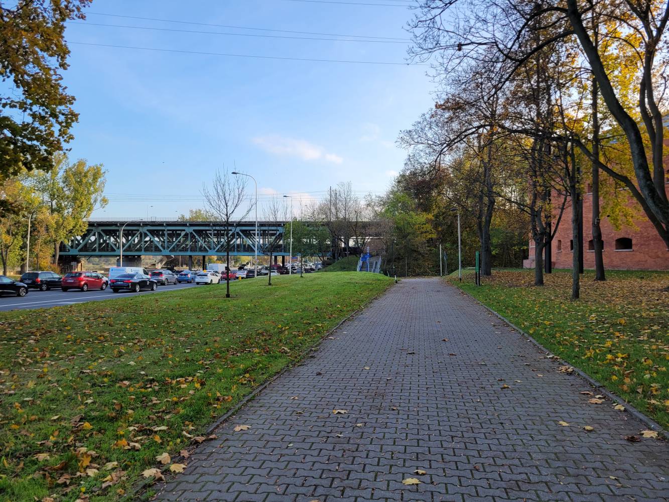
After Park Traugutta and the area near Konwiktorska, the route took us towards Most Gdański. Most Gdański is worth noticing because it connects the route back to the river and to the Cytadela area. It was built in 1957–1959 on the pillars of the first bridge under the Cytadela.
Bridges are simple on the map and longer in tired legs. By the time we were in the middle of Most Gdański, the route had already collected a lot of Warsaw behind us: Most Poniatowski, Aleje Jerozolimskie, the Royal Route, Plac Krasińskich, Żoliborz, Wisłostrada and Cytadela.

On the Praga side, the route ran along the Warsaw Zoo for roughly a kilometre. The Zoo officially opened on 11 March 1928, but the brief note I would keep here is from the Second World War. Jan and Antonina Żabiński lived in the villa on the Zoo grounds, and during the German occupation their home became a hiding place for people escaping from the Warsaw Ghetto. They were recognised as Righteous Among the Nations in 1965.

Later, around Port Praski, the route reached another kind of Warsaw history: river infrastructure and redevelopment. Port Praski was created in the 1920s and sits in an area where the river and the city have been repeatedly reworked. By then, I was thinking more about the finish than the port. I had started to accelerate too early, around 19.5 km, and paid for it with another short walk close to the end.
Back to Stadion Narodowy
The finish brought us back to the Błonia at PGE Narodowy. Monika had tried to catch me in four places on the route. Apparently she shouted, but I didn’t spot her in the city. I only saw her at the Błonia, just before the finish.
The final kilometres weren’t perfect. I had accelerated too early and still had to walk briefly about 600 metres before the line. The actual finish was controlled, and Monika even managed to take a photo where I didn’t look like I was dying. My heart rate wasn’t the main problem. The legs were.
The final average pace was 6:09/km, which was better than the plan on paper. The execution wasn’t better than the plan. I started too fast, paid for it, and made the second half harder than it needed to be.

The finish also had one more historical layer. PGE Narodowy was built in the basin of the former Stadion Dziesięciolecia. That older stadium officially opened on 22 July 1955. So even the finish area was not just a modern event space. It was another place where current Warsaw sits on top of an earlier Warsaw.
What stayed with me
This wasn’t a race for a personal best. My main focus at this point in the season was elsewhere, so I treated the half marathon more as training than a target race.
Still, it showed that going under two hours again is probably possible this year – but not by pretending that the first 10 km don’t count. The lesson was simple: plan better, and then actually follow the plan.
Looking at the route a few months later gave me another reason to value the race. We didn’t just run 21 kilometres through closed streets. We ran from a historic bridge past museums, monuments, palaces, planned districts, a fortress, a zoo, a port and a stadium built on another stadium.
On race day, most of that was background. That is normal. A half marathon is not a guided walk. But the route is still there after the medals, photos and split times. And it is worth going back to it more slowly.
Sources Used
- 20th Warsaw Half Marathon – official route page
- Fundacja Warszawa 1939 – Most Poniatowskiego
- Muzeum Narodowe w Warszawie
- Joanna Rajkowska – Greetings from Jerusalem Avenue
- Museum of Warsaw – the Copernicus Monument
- University of Warsaw
- Hotel Bristol
- Chancellery of the President of the Republic of Poland
- Biblioteka Narodowa – Pałac Krasińskich
- Regional Directorate for Environmental Protection in Warsaw – Las Bielański
- Museum of Independence / Museum of the X Pavilion – Cytadela Warszawska
- Museum of Warsaw – Most Gdański
- Warsaw Zoo
- Port Praski
- PGE Narodowy