
Trip date: July 2026
Route: Glinianka – Wola Karczewska – Kopki, following the Świder
Distance: about 9 km
Purpose: first local river-trekking test after the Rawka idea
This trip started about two years before we entered the Świder.
I had read Mikrowyprawy w wielkim mieście by Łukasz Długowski, and one chapter stayed with me. It was about a lowland-river adventure on the Rawka. Not mountain canyoning, not kayaking, and not normal hiking. Something in between: moving through the river itself, dealing with water, mud, branches, depth changes, cold and the practical problem of keeping things dry.
I remember talking about it with Monika. We both had the same reaction: one day we should try something like that.
For a long time, it stayed as one of those ideas in the background. Then, finally, we chose a Sunday and decided to do our own version. Not on the Rawka, but on the Świder.
The original plan was ambitious: start in Glinianka and continue roughly 18 kilometres towards Józefów. On paper it looked possible. I had also seen a kayaking route starting in Glinianka and following the Świder downstream towards Józefów. It was roughly 18 kilometres long, with one portage near Wola Karczewska and an average water depth of about 60 centimetres.
That number stayed in my head. It later turned out to be misleading in the way only averages can be misleading.
Before the river part, I made the day more complicated.
We expected to be tired at the end, so we decided to leave the car near the planned finish. There were buses and trains nearby, but after several hours in the water, returning by car sounded better. Since it was Sunday and I also needed to do a long run, I drove the car to the finish area at 6 in the morning, left it there, and then ran about 20 kilometres through the forests of Mazowiecki Park Krajobrazowy towards home.
At that point I still thought the river trekking would be easy-peasy. That’s one reason why doing the run first seemed reasonable. In my head, the Świder section would be slow, wet, maybe funny, but not especially demanding.
After the run I caught a bus home. From home, Monika and I had a direct bus to Glinianka. That was one practical reason for choosing it as the starting point: we could reach the river without complicated transfers. The whole plan depended on ordinary local infrastructure: a car park, a running route, bus stops, and a village near the river.
Glinianka wasn’t new to me. I had been there before for family events, including a First Communion at the wooden church of St Wawrzyniec. I had also walked through Glinianka while following the long-distance trail around Mazowiecki Park Krajobrazowy, and this year I ran through it during the Wiązowna Half Marathon. So I knew the place, but always from the road, the church, the trail, or the race route.
This time it had a different role. It wasn’t a village to visit, pass through, or run across. It was the entry point into the Świder.

On the bus we started reading more about Glinianka. That’s when the place became interesting again. We learned that it had once been a small private town connected with Wawrzyniec Dobrzyniecki. Sources use slightly different forms of the old name, including Wawrzynczew, Wawrzyńczew and Wawrzyńców, but the main story is consistent: the settlement had a town identity before it returned to the older name Glinianka.
WORTH KNOWING:
Glinianka and Wawrzynczew
Glinianka was once connected with a private town named after Wawrzyniec Dobrzyniecki. Sources use several forms of the old name, including Wawrzynczew, Wawrzyńczew and Wawrzyńców. The core story is clear enough: in 1557 Dobrzyniecki received permission to establish a town here, and in 1820 the authorities of the Kingdom of Poland removed its town rights and restored the older name Glinianka. The name Glinianka itself is usually linked with local clay deposits, from glina in Polish.
At Glinianka, my brother and his son were waiting for us on one SUP, which they used normally. Monika and I were doing the river trekking part: walking and swimming through the Świder. We also had a second SUP, which worked mostly as floating storage for food, water, dry clothes and phones.
That was important. Without the board, the trip would’ve been much more awkward, especially in deeper sections. With it, we had a bit more safety margin and a practical way to move the gear.

It was also over 30°C, which made the idea of spending several hours in the water much more attractive than it would’ve been on a colder day.
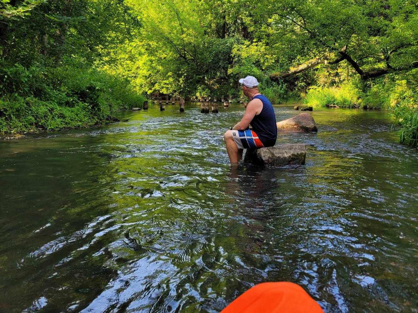
At first, the Świder was fairly shallow. It felt close to what I’d imagined: walking through the river, checking the bottom, moving slowly, laughing at the strangeness of using the river as a path.
Then it became deeper.
In total, there was probably about one kilometre where Monika and I had to swim because it was too deep to walk. This was the first serious correction to my assumptions. I had thought this would be mostly walking. Two years of swimming practice for triathlon suddenly became useful. This first section wouldn’t be a good choice for someone who can’t swim comfortably.
Later, when I reread the Rawka chapter, I realised that this was also part of Długowski’s story. The Rawka depth varied from about 0.4 m to 2 m, and they hadn’t expected that this would force them to swim. That detail made me understand our Świder attempt better. We weren’t unlucky. We’d simply discovered the same thing: a lowland river can be shallow most of the time and still make swimming unavoidable.
The closer we got to the weir in Wola Karczewska, the deeper the water became. The river no longer felt like a shallow walk. We had to work harder with every deeper section. The morning run suddenly looked less clever.
Wola Karczewska was a clear transition point.
At the weir there was a proper traffic jam. Kayaks and SUPs had to be taken out of the water, carried around the obstacle, and put back in again. Everyone had to solve the same problem: the river continued, but not smoothly.

At Wola Karczewska, the human work around the river was hard to miss. There was the weir, the portage, the kayaks waiting their turn, and the old mill story. People had used this section of the Świder for water power, later infrastructure, and now recreation. I don’t want to turn that into praise for reshaping rivers. It just made the place easier to read.

WORTH KNOWING:
The Mill and Weir at Wola Karczewska
Wola Karczewska has a long connection with water power on the Świder. PTTK describes a 19th-century water mill built in 1845-1850 on land separated from an estate in the Świder valley. The place was first known as Osada Młyńska, and the mill building was later used as a sawmill. The same source says that in the 1990s a new concrete weir was built, damming the river. Together, the mill history and the weir show the long use of water power and river infrastructure at this point on the Świder.
After the weir, the river changed again.
This second section looked more like what I’d imagined before the trip. It was shallower and more like river trekking than swimming. Most of the time I could walk. But it wasn’t easy. It was difficult in a different way.
The bottom kept changing. There was sand, mud, stones, rocks and other surfaces hidden under the water. Sometimes the ground was stable; sometimes it shifted. We had to go over branches, under branches, around branches, and sometimes straight through them. I hit underwater branches and stones many times. It hurt. By the end I had a few bruises.

None of this was dramatic by itself. One hit on a stone is just annoying. One branch catching your leg is just part of the route. But after hours in the water, those small things add up.
The first section had been physically harder because of the depth and swimming. The section after Wola Karczewska became mentally tiring: constant attention, constant checking, and constant small decisions about where to put the next foot.
We met many kayakers and people on SUPs along the way. In some places it felt like we were using the river in a strange way while everyone else was doing the normal version. They were floating. We were mostly walking inside the problem.
The SUP still helped. It carried the gear and gave us something useful in deeper places. But it didn’t make the route easy. It also had to be moved, steered, protected from branches and handled at obstacles. It was useful, but it was still part of the work.
Around the 6 km mark, we stopped for a short picnic on a sandy beach. That’s where the plan changed.

We looked at the map and admitted that the original 18 kilometres to Józefów was too much for this first attempt. I remembered a small pedestrian bridge in Kopki from a ride about a month earlier, when I did the final bicycle and gear setup test before Wisła 1200. It looked like a possible finish, and it was around 9 km into the route. That became the new goal.
I think that was the right decision.
There’s always a small temptation to continue only because the original plan says so. But finishing the full route wouldn’t have made the story better. It would’ve only made the day less sensible.
In the end, we covered about 9 km, and the whole river section took about 4.5 hours. A normal 9 km walk is one thing. A 9 km river trek through changing water depth, stones, branches, mud, swimming sections, SUP logistics and a weir is something else.
At the finishing point, my brother’s wife was waiting for us and gave us a lift back to the car park where I’d left the car early that morning.
That closed the loop: car, run, bus, river, lift, car.
Only later I learnt that this kind of activity has a name abroad: river trekking. It sounds more organised than it felt. In practice, for us, it meant walking through water, swimming when necessary, checking the bottom with our feet, managing a SUP, avoiding branches, getting hit by hidden stones, and slowly adjusting the plan to what the river allowed.
The trip also connected with another idea that has been on our mind for even longer than the Świder: Marsz Śledzia.
Marsz Śledzia is a water-walking route across Zatoka Pucka, along Rybitwia Mielizna / Ryf Mew, between Kuźnica and Rewa. I had heard about it before, but I hadn’t really connected it with what we were doing on the Świder. After this trip, the connection was obvious. It’s a bigger and more exposed idea, and not something to treat casually.
After the Świder, I respect this kind of activity more.
I wouldn’t plan the next river trek by starting with 18 kilometres. I’d plan 5 kilometres as the base route, with another 5 kilometres possible if everything goes well. Shorter sections, clear exit points, and the option to extend rather than the pressure to finish. That’s probably the most practical lesson from the day.
The second lesson is simple: river trekking isn’t only walking in water. Even on a small lowland river, swimming ability matters. The river may be shallow for long stretches, but one deeper section is enough to change the whole character of the day.
I’d romanticised the idea too much in my head. The real version had mud, branches, bruises, awkward portages, hidden stones and more swimming than expected. It was less smooth and less simple than I imagined.
But it was worth checking.
We didn’t complete the route to Józefów. We did complete the experiment.
And for a first river trek, about 9 km was enough.

Sources Used
- Łukasz Długowski, Mikrowyprawy w wielkim mieście
- PTTK Mazowsze: “Kościół pw. św. Wawrzyńca
- Izba Regionalna w Gliniance: “Glinianka”
- PTTK Mazowsze: “Młyn”
- Marsz Śledzia official website